
Tbd Pr 350 Unit Tract 6
Hubbard, TX 76648
- – beds
- – baths
- – sqft
- ~16 acre lot
- – on site
More homes
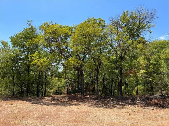
Tract 6: 15.50 Acres. Back on the Market! A deep ravine runs through this tract that would make an amazing backyard feature. Trim the trees and put a deer feeder on the other side and watch the wildlife while sipping your favorite beverage. Very fertile land to grow just about anything. The property is located just west of Hubbard and is only 30 miles from the Magnolia Market in Waco, Texas. It has simple deed restrictions put in place meant to protect your investment. A private road provides access to this tract from Highway 31 and it features a community automatic gate for security. Co-op water and overhead electric lines to each tract boundary have been completed which saves you a ton of money. Not many tracts left in this small development which is smack dab in the middle of the “Texas Triangle.” That means come look soon. Assoc. Broker Owner
![]()
Last checked:
As a licensed real estate brokerage, Estately has access to the same database professional Realtors use: the Multiple Listing Service (or MLS). That means we can display all the properties listed by other member brokerages of the local Association of Realtors—unless the seller has requested that the listing not be published or marketed online.
The MLS is widely considered to be the most authoritative, up-to-date, accurate, and complete source of real estate for-sale in the USA.
Estately updates this data as quickly as possible and shares as much information with our users as allowed by local rules. Estately can also email you updates when new homes come on the market that match your search, change price, or go under contract.
![]() Checking…
•
Last updated Apr 2, 2025
•
Checking…
•
Last updated Apr 2, 2025
•
MLS# 20523536 —
Location
-
Directions:From Waco, take Highway 84 east towards Corsicana. Take Highway 31 at the Y. Take the Business 31 exit and make a u-turn going back towards Waco and gate will be on the right.
-
Latitude:31.81150000
-
Longitude:-96.84570000
The Property
-
Property Type:Land
-
Property Subtype:Improved Land
-
Parcel Number:452021
-
# of Lots:1
-
Lot Features:Acreage, Agricultural, Few Trees, Mesquite, Oak, Pasture
-
Lot Size:10 to < 50 Acres
-
Lot Size SqFt:675180.0000
-
Lot Size Acres:15.5000
-
Lot Size Area:15.5000
-
Lot Size Units:Acres
-
Easements:Access, Utilities
-
Restrictions:Deed, No Mobile Home, Other
-
Current Use:Agricultural
-
Possible Use:Agricultural, Barndominium, Cattle, Horses, Hunting/Fishing, Livestock, Pasture, Ranch, Residential, Single Family
-
Zoning Description:N/A
-
Crops:Native
-
Vegetation:Grassed, Partially Wooded
-
Unit Number:Tract 6
-
Road Frontage Type:Highway, Private Road
-
Road Surface Type:Gravel
-
Will Subdivide:No
Listing Agent
- Contact info:
- No listing contact info available
Taxes
-
Tax Lot:6
The Listing
Utilities
-
Utilities:Co-op Water, Electricity Available, Private Road, See Remarks
Schools
-
School District:Mount Calm ISD
-
Elementary School:Mtcalm
-
Elementary School Name:Mtcalm
-
Middle School Name:Mtcalm
-
High School Name:Mtcalm
The Community
-
Subdivision Name:0115 - COPELAND
-
Association Type:None
-
Development Status:Other
Walk Score®
Provided by WalkScore® Inc.
Walk Score is the most well-known measure of walkability for any address. It is based on the distance to a variety of nearby services and pedestrian friendliness. Walk Scores range from 0 (Car-Dependent) to 100 (Walker’s Paradise).