


0 None Hosston Rodessa Road S
Ida, LA 71044
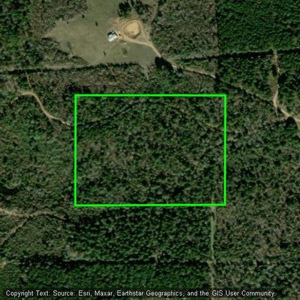
Map
- – beds
- – baths
- – sqft
- ~20 acre lot
- – on site
Looking for a private escape in Northwest Louisiana? This 20-acre tract in Ida is landlocked and accessible only by oilfield roads. Surrounded by rural land and oilfield sites, it features dense, wooded timber throughout—making it a prime spot for hunting, camping, or recreational use. While future development is possible, the heavy tree cover and remote location make it best suited for recreational purposes unless cleared. Buyer to verify access and zoning.
![]()
Last checked:
As a licensed real estate brokerage, Estately has access to the same database professional Realtors use: the Multiple Listing Service (or MLS). That means we can display all the properties listed by other member brokerages of the local Association of Realtors—unless the seller has requested that the listing not be published or marketed online.
The MLS is widely considered to be the most authoritative, up-to-date, accurate, and complete source of real estate for-sale in the USA.
Estately updates this data as quickly as possible and shares as much information with our users as allowed by local rules. Estately can also email you updates when new homes come on the market that match your search, change price, or go under contract.
![]() Checking…
•
Last updated Jul 17, 2025
•
Checking…
•
Last updated Jul 17, 2025
•
MLS# 21002849 —
Location
-
Directions:From Hwy 71, head west on Hosston Road South. Travel approximately a quarter mile past 15795 Hosston Rd S. Property is located off an oilfield access road on the east side. Land is landlocked and not accessible by public road. Closest GPS coordinates: 32.91581, -93.91554.
The Property
-
Property Type:Land
-
Property Subtype:Unimproved Land
-
Parcel Number:221509000004100
-
# of Lots:1
-
Lot Features:Acreage
-
Lot Size:10 to < 50 Acres
-
Lot Size SqFt:871200.0000
-
Lot Size Acres:20.0000
-
Lot Size Area:20.0000
-
Lot Size Units:Acres
-
Easements:Access, Other
-
Restrictions:Other
-
Current Use:Recreational, Timber, Unimproved
-
Zoning Description:Unrestricted rural land, currently landlocked. Surrounded by oilfield properties. Heavily wooded. No known zoning restrictions. Ideal for hunting, timber, or recreational use. Buyer to verify access and zoning.
-
Road Surface Type:Dirt
-
Will Subdivide:No
Listing Agent
- Contact info:
- No listing contact info available
Taxes
-
Tax Legal Description:20 ACS - N. 880 FT OF E. 990 FT OF SE/4 OF NE
The Listing
-
Virtual Tour URL Unbranded:https://www.propertypanorama.com/instaview/ntreis/21002849
Utilities
-
Utilities:Dirt, Gravel/Rock, Other
Schools
-
School District:Caddo PSB
-
Elementary School:Caddo ISD Schools
-
Elementary School Name:Caddo ISD Schools
-
High School Name:Caddo ISD Schools
The Community
-
Subdivision Name:rural
-
Association Type:None
-
Development Status:Unzoned, Other
Max Internet Speed
Provided by BroadbandNow®
This is the maximum advertised internet speed available for this home. Under 10 Mbps is in the slower range, and anything above 30 Mbps is considered fast. For heavier internet users, some plans allow for more than 100 Mbps.